Soi 6 Map
Updated: Sep 7

The Soi 6 Map helps visitors understand where Soi 6 is located in Pattaya and how the street connects to Beach Road, Second Road, Pattaya Beach, Central Pattaya, and nearby nightlife areas.
Located in Central Pattaya, Soi 6 is a convenient starting point for exploring several of the city's major entertainment districts.
Where Is Soi 6 Pattaya?
Soi 6 is located in Central Pattaya, between Beach Road and Second Road.
Its location makes it easy to combine a visit to Soi 6 with Pattaya Beach, Beach Road, restaurants, hotels, shopping, and other nightlife areas.
Soi 6 Location
Soi 6 → Beach Road → Pattaya Beach
Soi 6 → Second Road → Central Pattaya
The street's central location is one of its biggest advantages for visitors.
Soi 6 Pattaya Map
Use the map to understand the relationship between Soi 6 and the surrounding Central Pattaya area.
The map is particularly useful when planning:
Where to stay
Where to eat
Where to begin your evening
How to reach Soi 6
Where to continue afterward
How close Soi 6 is to other nightlife districts
Soi 6 and Pattaya Beach
Soi 6 is located close to Pattaya Beach.
Visitors staying near the beachfront can easily include Soi 6 in an evening itinerary.
A typical route could be:
Pattaya Beach → Beach Road → Soi 6 → Central Pattaya
This makes Soi 6 particularly convenient for tourists staying around the beach.
Soi 6 and Beach Road
Beach Road runs along Pattaya Beach and provides a major reference point when navigating the area.
Soi 6 connects into this part of Pattaya, making it easy to travel between the beachfront and the nightlife street.
See Soi 6 to Beach Road Map for a more detailed route.
Soi 6 and Second Road
Second Road is another major Pattaya roadway and an important transportation corridor.
Soi 6 connects Beach Road with the Second Road side of Central Pattaya.
This makes the street useful for visitors traveling between the beachfront and the interior parts of the city.
Soi 6 to Soi Buakhao
Soi Buakhao is one of Pattaya's major nightlife corridors.
Visitors can combine Soi 6 and Soi Buakhao during the same evening.
A possible route is:
Soi 6 → Central Pattaya → Soi Buakhao → LK Metro
Soi 6 to LK Metro
LK Metro is another compact nightlife district in the Central Pattaya area.
Visitors can travel between the two areas by local transportation or other available options.
Soi 6 to Walking Street
Walking Street is located farther south in Pattaya.
Visitors staying near Soi 6 can travel toward South Pattaya after exploring the area.
A popular nightlife route could be:
Soi 6 → Soi Buakhao → South Pattaya → Walking Street
Soi 6 Nightlife Map
The Soi 6 nightlife area is concentrated along the street, making it relatively easy to explore on foot.
The surrounding map can help visitors identify:
Bars
Restaurants
Hotels
Transportation routes
Nearby streets
Beach access
Other entertainment areas
Hotels Near Soi 6
One of the benefits of using a Soi 6 map is being able to identify accommodation within walking distance.
Staying nearby can make it easier to:
Walk to Soi 6
Reach Beach Road
Visit Pattaya Beach
Explore Central Pattaya
Continue to other nightlife districts
Restaurants Near Soi 6
There are numerous restaurants and food options around Central Pattaya.
Visitors can use the map to locate restaurants near Soi 6 before beginning an evening of nightlife.

How to Get to Soi 6
Depending on where you're staying, you can reach Soi 6 by:
Baht bus
Motorbike taxi
Taxi
Ride-hailing service
Walking
Visitors staying in Central Pattaya may find Soi 6 convenient to reach on foot.
Soi 6 Walking Map
Because Soi 6 is a relatively concentrated street, walking is one of the easiest ways to explore the immediate area.
A simple walking route is:
Beach Road → Soi 6 → Second Road
From there, visitors can continue toward Central Pattaya or use local transportation to reach another district.
Nearby Pattaya Nightlife Areas
The map also helps show how Soi 6 fits into Pattaya's larger nightlife network.
Nearby or easily accessible areas include:
Beach Road
Central Pattaya
Soi Buakhao
LK Metro
South Pattaya
Walking Street
This makes Soi 6 a useful stop when exploring Pattaya nightlife by area.
Soi 6 at Night
The map becomes particularly useful after dark because visitors can plan their route before heading into the busy nightlife streets.
See Soi 6 at Night for a detailed nighttime guide.
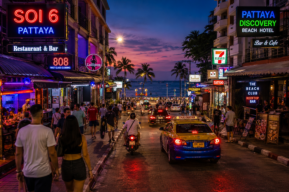
You can also explore Soi 6 Nightlife Photos and Soi 6 Nightlife Videos to see what the area looks like after sunset.
Soi 6 Map for First-Time Visitors
If you're visiting Soi 6 for the first time, keep the route simple.
1. Find Beach Road.
2. Locate Soi 6.
3. Walk through the street.
4. Continue toward Second Road.
5. Decide whether to explore Central Pattaya, Soi Buakhao, LK Metro, or another nightlife area.
This gives you a straightforward way to understand the geography without trying to navigate the entire city at once.
Soi 6 Map and Pattaya Nightlife
Soi 6 is only one part of Pattaya's nightlife network.
Use the broader Pattaya Nightlife Map to compare its location with Walking Street, Soi Buakhao, LK Metro, Beach Road, Jomtien, and Naklua.
For the complete area overview, start with the Soi 6 Pattaya Guide.
Final Soi 6 Map Guide
The Soi 6 Map is useful for understanding the street's central location and its connections to Pattaya Beach, Beach Road, Second Road, and nearby nightlife districts.
For the best overall experience, combine the map with the Soi 6 Pattaya Guide, Soi 6 at Night, Soi 6 Nightlife, photos, and walking-tour videos.


Comments